
FYP 2010-2011 - Sindh Flood Maps receives Silver Medal
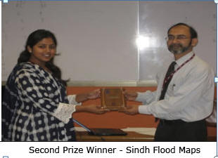 Sindh
Flood Maps is a community-based Geographical Information System (GIS)
developed by Sana Ahmad, a student of BS (CS) at IBA under the
supervision of Dr. Sayeed Ghani. The project is a Social Network Map
that assists in disaster management and relief and development
activities throughout Pakistan, especially in Sindh. It provides one
platform where people can report emergencies, and concerned authorities
can manage their resources accordingly and effectively to help them. The
application of the project, however, is not limited to these two areas
alone. The system allows its users to upload kmz (compressed Google
Earth) files which would appear in the form of layers on the map
dynamically. All uploaded data can be viewed by members in the form of
super-imposable layers that aids decision making regarding various
issues in Pakistan. The project makes use of many features available in
Google Map API as well as a large number of geographical layers created
by online communities.
Sindh
Flood Maps is a community-based Geographical Information System (GIS)
developed by Sana Ahmad, a student of BS (CS) at IBA under the
supervision of Dr. Sayeed Ghani. The project is a Social Network Map
that assists in disaster management and relief and development
activities throughout Pakistan, especially in Sindh. It provides one
platform where people can report emergencies, and concerned authorities
can manage their resources accordingly and effectively to help them. The
application of the project, however, is not limited to these two areas
alone. The system allows its users to upload kmz (compressed Google
Earth) files which would appear in the form of layers on the map
dynamically. All uploaded data can be viewed by members in the form of
super-imposable layers that aids decision making regarding various
issues in Pakistan. The project makes use of many features available in
Google Map API as well as a large number of geographical layers created
by online communities.